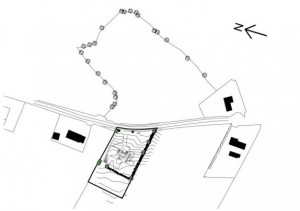
An electronic survey is highly recommended for any sloped or awkward sites; e.g. where traffic sightlines are not easily achieved. Declan Noonan & Associates use total station survey equipment and Civil3D software to provide clients with a contours survey map.
An electronic survey allows for an accurate map of a site. A map traced from an OSI map is commonly used for the purposes of planning but the accuracy of such a map is limited. An accurate electronic site map will also aid in the design of the house and can increase the chances of an application being successful as the proposed development will be better presented to the Planning Authority with accurate site sections and an accurate presentation of other site features. An accurate site survey will also be of benefit to a client, once a proposal goes to construction as differences in ground levels will be accurately represented on the map. This will aid when looking for accurate prices of rising walls and ground works.

Comments are closed.